
Operation Sea Lion, also written as Operation Sealion (German: Unternehmen Seelöwe), was Nazi Germany’s code name for the plan for an invasion of the United Kingdom during the Battle of Britain in the Second World War. Wikipedia

Militärgeographische Einzelangaben über England
Maps of England showing features of military significance
Militärgeographische Objektkarten mit Objektbildern
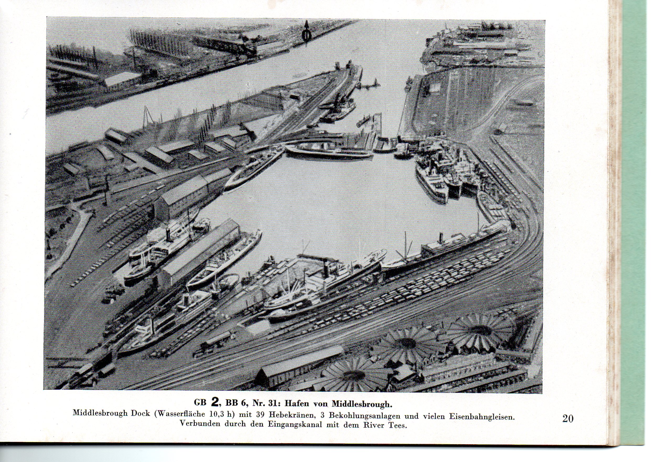
Maps of military installations with photographs.
Background information
In preparing for the invasion of Great Britain (Operation Sea Lion), a vast amount of information, including maps and photographs, was assembled by the German military. The maps in this collection were arranged in groups, based on the Ordnance Survey Quarter-inch Fourth Edition sheet lines, and distributed in pale green A4 size folders, which also included a book of postcard-sized photographs.
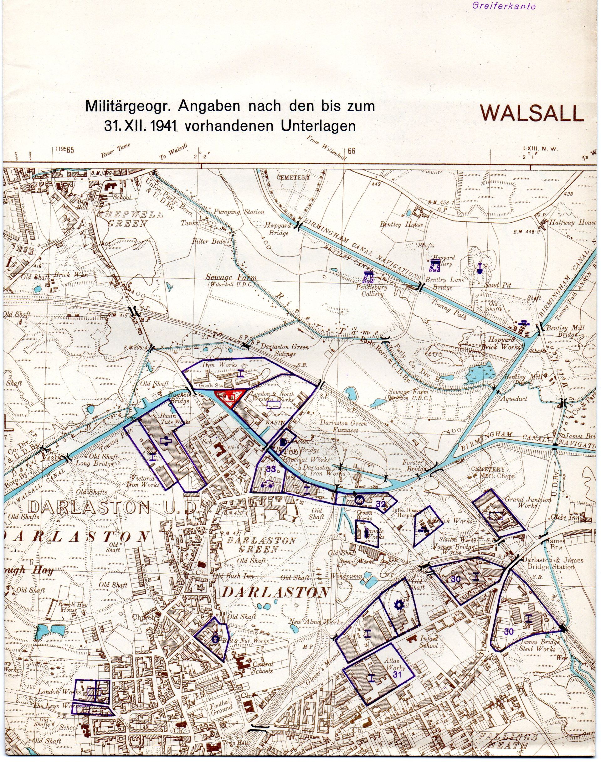
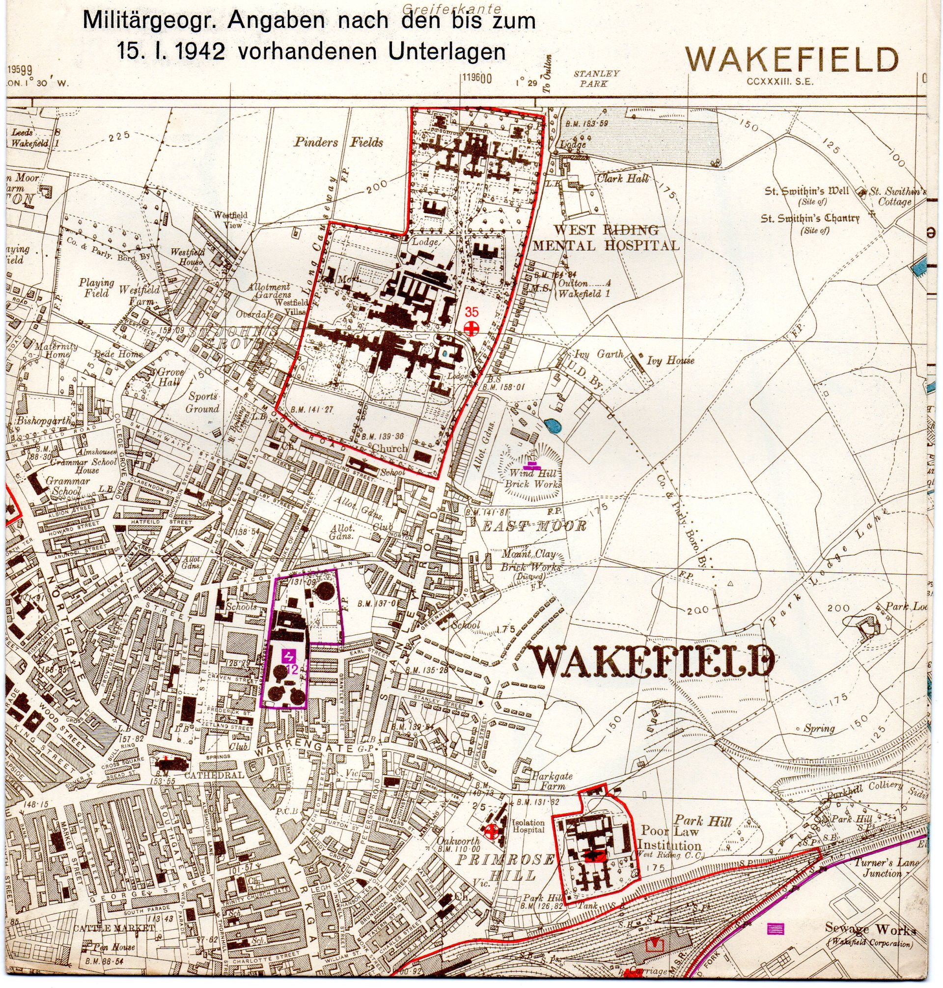
Thus, each numbered folder has a quarter-inch map of the area, a book of photographs and large scale plans of significant towns. The quarter-inch (1:250,000) maps use an extensive list of purple symbols for industrial sites (e.g. chemicals, waterworks, textiles, electricity) and red symbols for strategic sites (e.g. hospitals, airfields, radio stations, barracks). The large scale plans are usually 1:10,000 scale (metric six-inch), and again are an Ordnance Survey base map with coloured symbols showing sites of military significance such as airports, railway workshops, docks, bridges. Such sites are often illustrated in the book of photographs, the captions of which give a map location for each site, and each mapped site gives the book illustration number.
Sheet size is usually 18.5″ by 12.5 inches, with larger combined sheets showing some towns on a single sheet.
The town maps are very attractive, being printed in brown (rather than black), with blue water.
The various coloured symbols stand out clearly, are easily seen and are quite striking. The delicate black bridge symbols are especially noticeable and numerous, as are the red boundaries of railway stations and goods yards. Basically, for each town these maps show all locations that the Germans thought to be strategically important. They also double as a large scale pre-war Ordnance Survey map.
All folders were issued in 1941 or 1942 and are headed : Nur für den Dienstgebrauch! : For Official use only.
Generalstab des Heeres. Abteilung für Kriegskarten und Vermessungswesen (IV. Mil.-Geo.). Berlin 1941 (or 1942).
Military High Command / Department of Military Cartography and Surveying (IV.Mil.-Geo.) / Berlin 1941 (or 1942).
Three individual folders are available :
Condition
Overall, the maps are in very nice condition, and are usually internally bright, with any damage being slight, usually confined to dusty edges, slight foxing, very occasionally a light water stain or small tear to map edge. The pale green used for folder and book covers has faded in places, where it is now a light brown colour.
Folder 2. [North Central] Nördliches Zentralgebiet


Click an illustration to enlarge it.
- 1. 1:250,000 : Sheet 2, North Central (February 1942)
- 2. Town plans 1:10,000 (Dated 30.iv.1942)
Barrow in Furness : BB 8a, b
Preston : BB 8c, d
Accrington : BB 9e, f
Blackburn : BB 9g, h
Keighley : BB 9ae, af : Thus 10 sheets
- 3. Book of photographs (6 May 1942, 45 pages)
- Maps in good condition as described above. Booklet loose. Good clean folder with slight foxing.
- £340 post free.
Folder 6. [North Midlands] Nord-Midlands


Click an illustration to enlarge it.
- 1. 1:250,000 : Sheet 6, North Midlands (31 December 1941)
- 2. Town plans 1:10,000 (Dated 15.i.1942)
Burnley : BB 9a, b, c, d
Halifax : BB 9i, k, l, m
Bradford : BB 9n, o, p
Leeds : BB 9q, r, s, t, u, v
Dewsbury-Batley : BB 9w, x
Wakefield : BB 9y, z
Huddersfield : BB 9aa, ab, ac, ad
Sheffield : BB 13a, b, c, d, e
Lincoln : BB 14 Combined sheet
Grimsby : BB 14e, f
Nottingham : BB 17 Combined sheet
Derby : BB 17c, d, e
Leicester : BB 17f, g : Thus 39 sheets
- 3. Book of photographs (12 March 1942, 66 pages)
- Maps in good condition as described above, a few with slightly dusty edges. Front folded surface of sheet 6 is slightly stained. Light staining to book cover.
- Folder in sad condition.
- £1320 post free.
Folder 8. Midlands


Click an illustration to enlarge it.
- 1. 1:250,000 : Sheet 8, Midlands (August 1941)
- 2. Town plans 1:10,000 (Dated 31.xii.1941)
Walsall : BB 17h, i, k, l
Dudley : BB 22a, b, c, d, e
Birmingham : BB 23a, b, c, d, e, f, g, h, i
Coventry : BB 23 Combined sheet
Rugby : BB 23m, n
Northampton : BB 23
Gloucester : BB 27g, h, i, k
Oxford : BB 28 (1. 8. 1941) : Thus 27 sheets
- 3. Book of photographs (7 October 1941, 35 pages)
- Maps in good condition as described above. Folder stained and torn.
- £920 post free.